One of Flagstaff’s longest standing MTB events, held at the Arizona Nordic enter. Escape the heat and come play in the Aspens. This is the The Bear Jaw Groove! 6 hour MTB Relay (Single, Duo, Quad) and 22 Mile Sprint, 33 Mile Endurance, and the 44 Mile Ultimate!
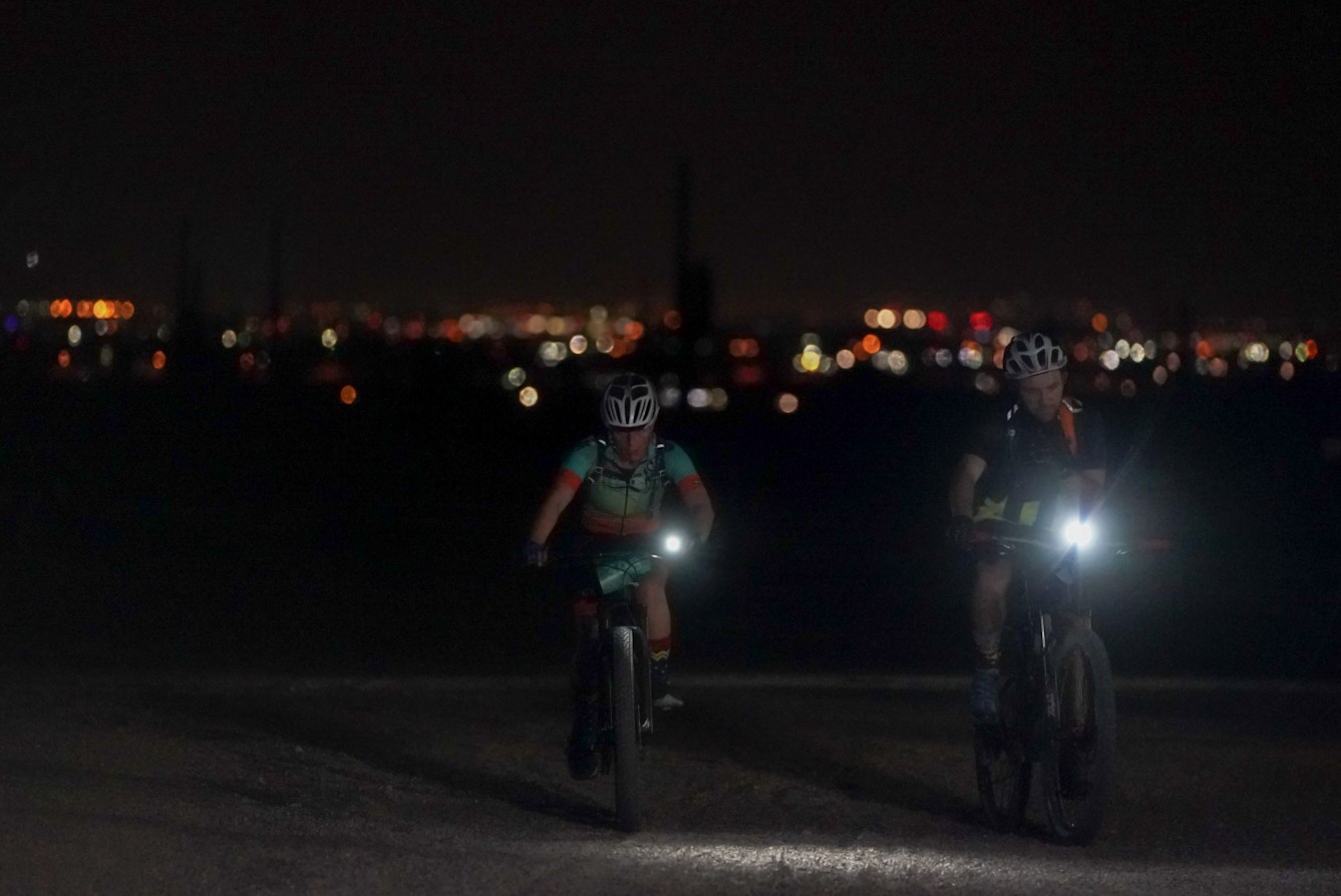
Experience the magic of night trail riding in the Sonoran desert at the Vertigo Night Trail Rides held on a rolling 7 mile loop at the White Tank Mountain Regional Park competitive track. This is a perfect beginner night ride with distances for all. Ride past towering saguaro cactus under the night stars!
This race is part of the Insomniac Night Trail Ride Series with events all across the state of Arizona. Join us and “Carpe Noctem” to “seize the night”!
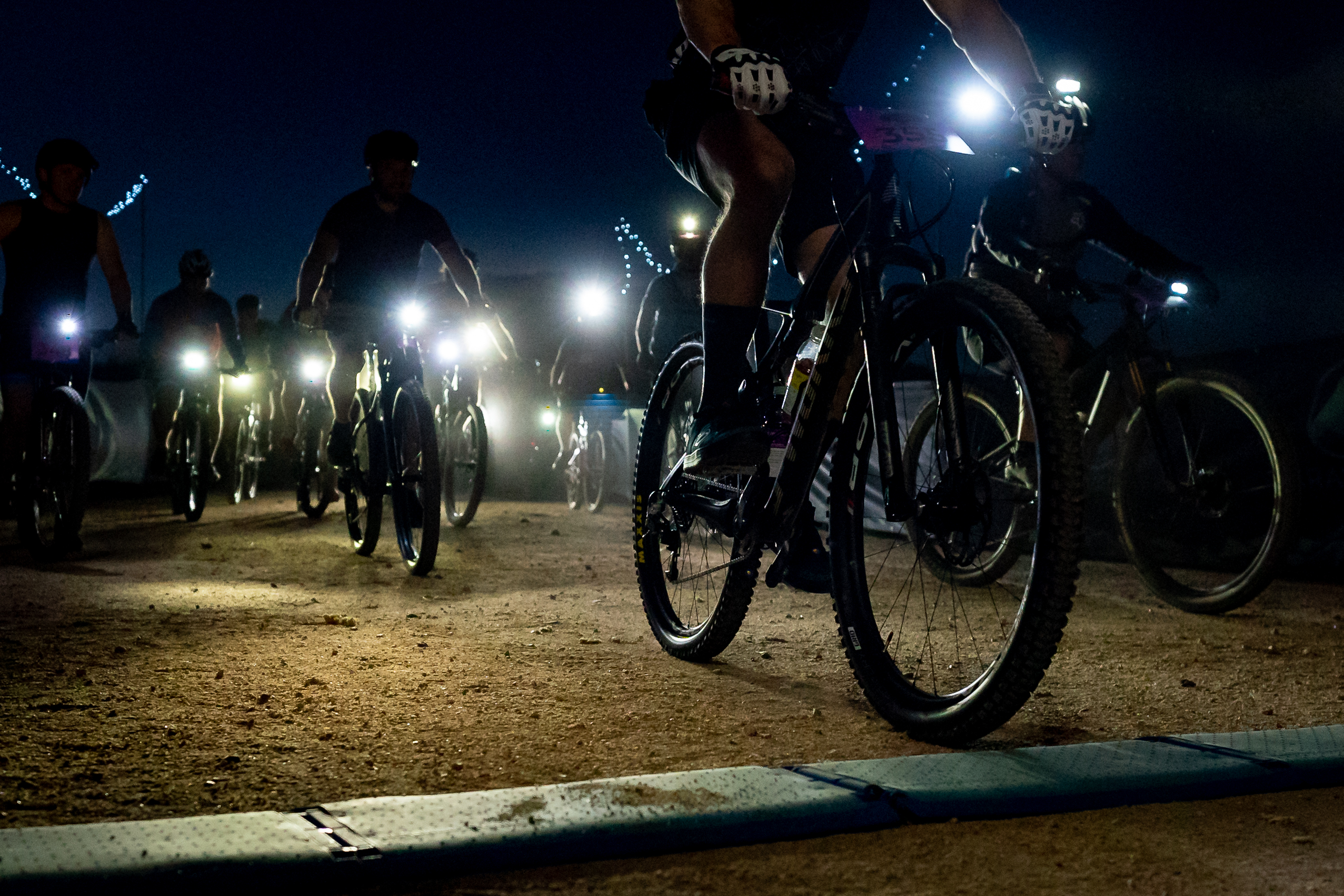
Experience the magic of night trail riding in the Sonoran desert at the Adrenaline Night Trail Rides held on a rolling 9.5 mile loop at McDowell Mountain Regional Park. This is a perfect beginner night ride with distances for all. Ride past towering saguaro cactus under the night stars!
This race is the 2nd in the Insomniac Night Trail Ride Series with events across the greater Phoenix, Arizona area. Join us and “Carpe Noctem” to “seize the night”!
When:
November 16, 2024
The B (49 miles) and C (22 miles) routes will start at 7:30am. The A route (76 miles) will start at 5am.
Where:
You will start at the Picketpost trail head off of Route 60 near Superior, Arizona. This is about 60 miles east of Phoenix and about 5 miles west of Superior. If you pass the Boyce Thompson Arboretum, you’ve missed the trailhead turnoff. You can get directions to the start here.
The trailhead has pit toilets, but no water. Also no trash receptacles – pack it in, pack it out.
Camping is NOT allowed at the trailhead. There are however, a bunch of places to primitive camp beside the road that leads to the trailhead.
What:
The Punisher will once again be split into 3 different lengths so that you can choose the amount of punishment you deserve. Make sure you review the GPS files.
The C ride will be the shortest AES ride ever. A measly 22 miles and about 2300 feet of climbing. In place of FR4, you’ll get to ride new trails in Arnett Canyon. The route will climb on dirt roads part of the way up Montana Mountain. The descent back down will be on the Arizona Trail back to the Picketpost trailhead. Easy peasy.
The B ride is heading south this year. It is actually a subset of one of the previous year’s A route – without crossing the Gila River. You will head south on the Arizona Trail to FR4, then turn south on FR4 (it is not closed in this area). You’ll climb up on the ever lovely Telegraph Canyon road, then down, past Ajax Mine to Box Canyon. There will be a hard left to get you over to Martinez Canyon. After traversing the “brass knuckles” you’ll end up at the Gila River not far from the Arizona Trail. Filter water at the river, then head north to the AZT – all the way back to Picket Post.
The B ride has an opportunity for a time bonus. You’ll notice a little additional part of the route in Box Canyon. This goes to a section where the canyon gets very narrow – really cool to see. This is an out and back of about 3.75 miles. Do this and take a selfie. Your selfie, along with your GPS track, will get you an hour deducted from overall time.
The A ride (aka: The Pulverizer) will be the same stroll in the park as last year. You’ll begin by heading south on AZT down to the Gila River. You’ll cross the river (good chance to filter water) and start climbing to Florence-Kelvin Highway. You’ll then bomb down that dirt road all the way to Kelvin Bridge. From there it is AZT all the way back to the start.
READ THIS IF YOU ARE THINKING ABOUT DOING THE A RIDE:
The A ride is a seriously difficult ride. It is only for very experienced and capable back country endurance cyclists. One of your sources of water is the Gila River – and that needs to be filtered. If you cannot meet the following criteria, don’t even bother:
1. You must have a GPS and know how to use it. There are no trail signs and it will be very easy to get lost.
3. You need to be prepared to be on your bike for 10-15 hours or more. Some VERY fast folks have done this in 10 hours. Expect it to take longer for most everyone else.
4. You must have lights and be comfortable with riding at night in challenging terrain.
Water:
In a race of this length and remoteness, water is a concern. Bring as much as you can! We’ve done some scouting and found some possible and some dependable water sources. Water sources are marked (as waypoints) on the GPS files.
Route:
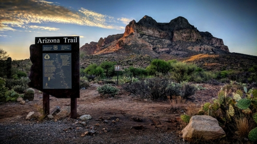
It is HIGHLY recommended that you bring, and know how to use, a GPS for this race. The Legends of Superior section has lots of areas where it is easy to miss the trail and get off course. Using a GPS and paying attention are the best ways to stay on course and not get lost. GPS files for all three courses can be obtained at the links below. PPP_C_route PPP_B_route(punisher) PPP_A_route(pulverizer)
When:
November 2, 2024 at 9:00 am (9:15 start time for those doing the short course)
Where:
Kentucky Camp, 40 miles south of Tucson. Google maps link here.
What:
There are two options for this race, (1) a 29-mile lollipop or (2) a 46-mile figure 8. There will be camping available and a post-race party in the area for those that would like to grill. This year, we are doing the Kentucky Camp as a charity event for the Arizona Trail Association. If you want to ride and are not a member, please become a member here: https://aztrail.org/get-involved/join/
When: The 100 event will start at 6:00 a.m. The 60 mile event will start at 7:00 a.m. on August 24, 2024
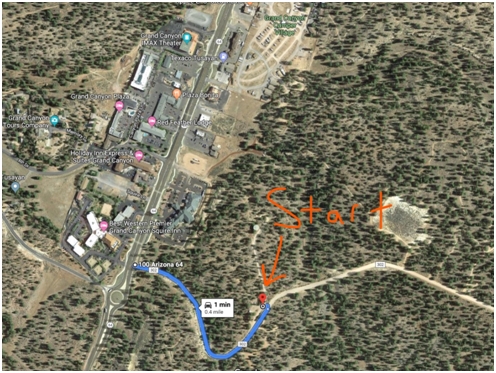
Where: The start/ finish will be on Forest Road 302 located on the south end of Tusayan, half a mile east from the roundabout on Hwy 64.
Lots of parking and lots of camping options right at the start/finish area on both sides of FR302.
The routes:
Option #1: 60 Mile route that is a loop with fun double track all the way to the turnaround at the historic Moqui Stage Stop and follows the Arizona Trail all the way back to Tusayan. An epic ride for any ability.
Option #2: 94 mile route that includes 40 miles of double track forest service roads with literally no traffic all the way to the turnaround where you will ride the Arizona trail all the way back to Tusayan.
****Grandview Lookout will be on the route approximately 16 miles from the finish with a requirement to climb it. The views are worth the climb up. If you fear heights, you don’t have to climb it. ******* Time bonus for the ones that climb it. Selfie pic for proof******
Fully self-supported ride. Russell tank has water and can be filtered if needed. There will be NO water drop unless we have a volunteer drop and pick up at Russell Tank or elsewhere. Russell Tank is a reliable filtering tank.
23
Where: The start/ finish will be on Forest Road 302 located on the south end of Tusayan, half a mile east from the roundabout on Hwy 64.
Lots of parking and lots of camping options right at the start/finish area on both sides of FR302.
Route:
The Tussle will be a loop rather than the out and back. The route will be ridden in a counterclockwise fashion with the route consisting of 25 miles of scenic remote forest service roads, 35 miles on the Arizona Trail and 1 mile of asphalt/concrete riding through Tusayan back to the finish.
****Grandview Lookout will be on the route approximately 16 miles from the finish with a requirement to climb it. The views are worth the climb up. If you fear heights, you don’t have to climb it. ******* Time bonus for the ones that climb it. Selfie pic for proof******
Fully self-supported ride. Russell tank has water and can be filtered if needed. There will be NO water drop unless we have a volunteer drop and pick up at Russell Tank. Russell tank should have plenty of water for filtering with all the monsoon activity.
ROUTE 36.6 miles/1400 feet ascent and will be close to 16 mph average.
If you want to go on a slightly shorter and slightly slower ride, sign up with the C ride HERE which will be starting/ending at the same place and time.
Weather: Check back the night before the ride and if rain is forecasted, the ride will be postponed by one week.
Route: We will share the roads with traffic for ~60% of route which will have shoulders/bike lanes. There is almost no traffic on the 4 mile climb on the Trail’s End spur. Approximately 40% will be on the loop.
Begin: St. Philips Plaza South parking lot
End: Feel free to join us at Ren’s Coffeehouse after the ride.
NOTE: There have been some bicycle thefts recently at Ren’s so keep your bicycle at your elbow or lock it up while you have coffee.
Water/Bathroom Breaks:
9 miles – 1161 W Silverlake Rd (short stop)
21.0 miles – Feliz Paseos Park (long stop)
30 miles – Rillito Park at Camino De La Tierra (if needed)
Please arrive 15 minutes early to sign in. If you sign up for the ride and are running a couple of minutes late call Ed at 915-238-3188 and we will wait up to five minutes before leaving.
Load the route into your bicycle computer, it will help if you get separated from the group or if your leader doesn’t load it correctly.
If you haven’t ridden with me before, I will not have your contact information. If so, please send your name, phone number, emergency contact, emergency contact phone number (NOT 911) to Ed at erschultz@gmail.com. If you are bringing a +1, send their information as well. The ride waiver will be filled out prior to the ride, you will just need to verify the information and sign it.
There is a good chance that this C+ ride will end with an average speed of 16-17mph. If you are not comfortable or not capable of this expected pace average, please do not participate in this ride. Note that this is a full drop ride. If you can’t keep up, you will be dropped. If you have the breath for it, this will be a social ride with lots of conversations. Riders are expected to ride at the pace of the ride leader and between the ride leader and the sweep. There will be ride-at-your-own-pace sections and regroup areas designated by your ride leader.
If you are not a member of our cycling club, please join: Sign Up Link
What to Bring:
Food & fluids for 3 hours – 2 24oz Bottles or Hydration Pack.
Bring a tube/patch kit and a way to inflate your tires.
Be sure your bike is in good mechanical condition.
CPSC approved helmets must always be worn while riding.
No ear buds! This is a safety requirement, not a request.
If you are riding, I ask that you agree that:
You will obey traffic laws. Drive your bike as you would your car.
You are a representative of the greater cycling community and will therefore conduct yourself appropriately.
You will represent GABA well.
This is not a “training” or “intensive” ride – this is a social, no drop, base building ride.
If any of these standards are unclear, you will ask for clarification.
Route subject to change based upon, weather, road conditions, group requests, and or the ride leader getting lost.
Safety/Legal Refresher: If you made it this far, then you probably have some free time on your hand to see about cycling in Oro Valley. Click HERE for more information about laws, paths, plans, …. in the OV.
Did you know that OV has one bicycle law? What is it?
Join us for a mellow cruise from Himmel to Underwood Family Sonoran Landscape Laboratory to enjoy some breakfast and great company!
We’ll bring our BOB Trailer loaded up with pancake making gear. Bring a plate, cup, fork if you are able to (If not, we’ve got you!) and an appetite for pancakes. You are also welcome to bring your own camp stove to brew yourself some coffee or tea if you prefer or want..
Meet us at Himmel Park at 7am. We’ll be meeting at the north parking lot near the library. Then we’ll mosey on over to Underwood Family Sonoran Landscape Laboratory arriving around a little after 7:30.
Join us for a mellow cruise from Himmel to Highland Quad (Tree Ring Laboratory) to enjoy some breakfast and great company!
We’ll bring our BOB Trailer loaded up with pancake making gear. Bring a plate, cup, fork if you are able to (If not, we’ve got you!) and an appetite for pancakes. You are also welcome to bring your own camp stove to brew yourself some coffee or tea if you prefer or want..
Meet us at Himmel Park at 7am. We’ll be meeting at the north parking lot near the library. Then we’ll mosey on over to the Highland Quad in the U of A arriving around a little after 7:30.
***If you would like to join this ride but it is cost prohibitive to do so or if you need to borrow gear to make it happen, please let us know.
We’ll be leaving Campfire Cycling at around 9AM for a +/- 30 mile ride down the loop (Paved bike path) most of the way to Colossal Cave State Park We’ll be staying at a group campground with room for 20 tents. We will also be setting aside a middle meetup option for folks that don’t want to/can’t ride the full 30 miles.
On our Community Events/Rides we follow our Campfire Code of Conduct. We strive to create a positive and supportive environment where everyone feels welcome and heard. We don’t assume anyone’s abilities based on outwards appearance. We take responsibility for our actions and words. We respect the land, it’s original stewards and leave no trace.
If this is your first bikepacking trip, we are here to help. If you like advise on gear need or want any other advice we strongly recommend you stop by with your bike or pack up your bike for the trip and bring it by the shop so we can checkout your setup and make recommendations as needed. Feel free to setup an appointment or just stop on by.
While this is a beginner oriented bikepacking trip, everyone is welcome. I’m sure all of the newbies will appreciate having experienced campers along for the ride. It’s a great opportunity to do a shake down run with new gear or a new to you setup as well as sharing experinece, knowledge and setups.
This will be a no drop ride. We ride at a party pace with many stops and chances for regrouping as well as resupply. Campfire Cycling will also always have a mechanic at the back of the ride so no one is left behind in case trouble arises. There is also food available near the camp.
Please be prepared with all of your own camping gear, food and water. This will be semi remote camping without many supplies nearby. Campgound has vault toilets and running water. There are businesses and a grocery store on the route with markets nearby the entrance/exit of the campground.
Protect the Land we Ride on. For this trip we will have beautiful scenic views of the Santa Rita Mountains who’s unique environment is under threat to some heavy mining. Rosemont Canadian Company want to extract and export copper while dumping tons of wast into a mile wide hole that will seep lots of toxins into our groundwater. The Tohono O’odham Tribe as well as many conservation groups have been fighting this mine and for years. We recommend visiting: The Sky Islands Alliance, The Calabasas Alliance, Save the Scenic Santa Ritas. Donate, show up to events and get involved!